
Randolph Street Directory Address Trail
A street-by-street search in Randolph is strongest when it follows the record keys rather than trying to make one source answer every question. The Morris County Tax Board supplies a current property location, owner of record, block and lot. GIS places that parcel among nearby roads and tax blocks. The County Clerk then links recorded parties and documents to the same legal parcel. Old address sections in directories can supply historical context, while election material has its own limited, statutory access route. None of these sources alone establishes the complete household at a property.
Start with a precise house number and road spelling. Keep a small research log with the tax year, parcel identifiers, source date, and whether a name is an owner, recorded party, directory entry, or other role. That prevents a common error: treating a mailing address or an old transaction as proof of present occupancy.
- Open the Morris Tax Board property-location search, select Randolph Township and the tax year, then enter the house number and official street name.
- Save the owner of record, situs address, block, lot, qualifier, and any prior parcel identifier shown in the result.
- Find the parcel in Morris GIS, inspect the road and adjacent parcel shapes, and use the map only as location context.
- Search the owner in the County Clerk Party Name index, narrow to a deed or another recorded instrument when appropriate, and compare the legal description.
- For an earlier household question, use a dated address section or criss-cross volume at a library, then confirm the timing against the parcel and deed trail.
Search Randolph Streets in Tax Records
The Morris County Tax Board Search Tax Records form is the practical first stop for an address. Property Location requires a Property Tax Year, Property District, and Street Name; house number is optional. Choose Randolph Township as the district. The interface also supports owner, block-and-lot, and prior-block-and-lot routes, so a changed number or divided parcel does not end the search. The observed year menu runs from 2000 through 2026.
| Tax-search field | Input | Required | Randolph use |
|---|---|---|---|
| Property Tax Year | Dropdown | Yes | Select an observed year from 2000–2026. |
| Property District | Dropdown | Yes | Choose Randolph Township. |
| House Number | Text | No | Use the current number when known. |
| Street Name | Text | Yes | Use the official road spelling. |
| Owner | Text | Yes on owner route | Useful after an address identifies the parcel. |
| Block, Lot, Qualifier | Text and dropdowns | Yes on parcel routes | Use current or prior identifiers when a parcel changed. |
The official tax-search screen shows the address, owner, and parcel search paths that make a Randolph street search repeatable.
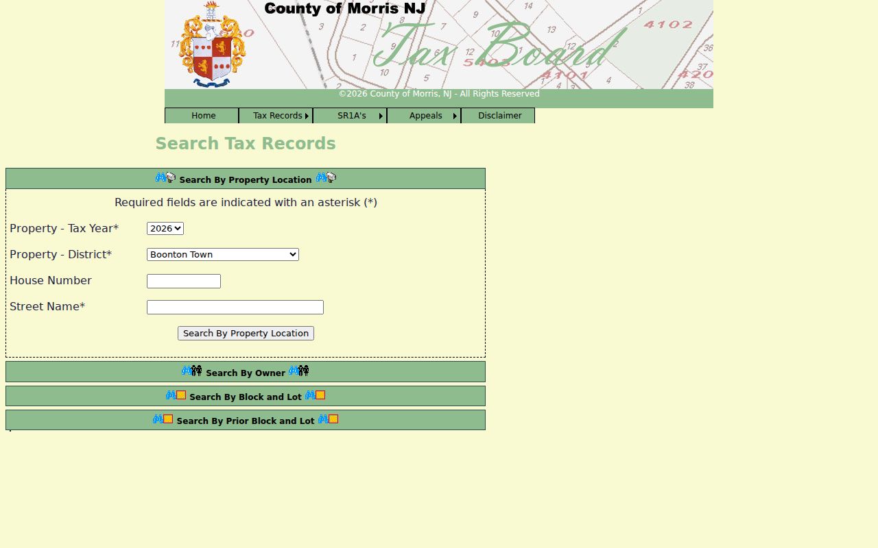
Record the displayed parcel key before moving on. A tax result is evidence about the property and owner of record, not a full roster of people connected to the address.
Randolph Parcel Keys by Address
Street numbers can be useful for a current search, but the durable connection between Randolph address records is usually the parcel identifier. A parcel is a defined piece of land in the tax system. The situs address is the physical property location. An owner mailing address, when the tax record exposes one, is where correspondence is sent and may be elsewhere. Keep those fields labeled separately. A Randolph mailing address does not by itself prove that the owner lives at the parcel, and an outside mailing address does not defeat ownership.
Subdivisions and older descriptions make the prior-block-and-lot route especially important. The Tax Board permits a search using earlier identifiers, while a deed or map can retain a legal description that survives a changed street number. That combination is more reliable than guessing from a road name alone.
- Parcel
- A tax-mapped unit of land identified by block, lot, and sometimes a qualifier.
- Situs address
- The street location of the parcel, distinct from an owner’s correspondence address.
- Plat or subdivision map
- A recorded map that shows lots, blocks, roads, and their relationship to one another.
- Criss-cross directory
- A historical directory organized by address or street section so entries can be read house by house.
Browse Randolph Streets in GIS
The Morris GIS Parcel Searcher accepts municipality, owner name, street address, or parcel ID in its quick search. Map and Results views let a researcher select a parcel and inspect the surrounding street. The Buffer in Feet control can make a nearby-parcel set reproducible. It is a useful way to distinguish similar street numbers, road segments, and parcel shapes before checking the tax record or deed index.
The parcel viewer is an identify-and-locate tool, not a survey or a legal description. Its data can show linked MOD-IV parcels, tax blocks, address points, structures, zoning, overlay zoning, road centerlines, and FEMA flood layers. The legal description in the recorded deed remains the safer key when old addresses and current mapping differ.
Note: A Morris GIS notice dated August 26, 2026 said Legacy Tax Search was working while its familiar background map was being recreated and hardware work continued.
The Parcel Searcher source screen illustrates its quick-search and map workflow.
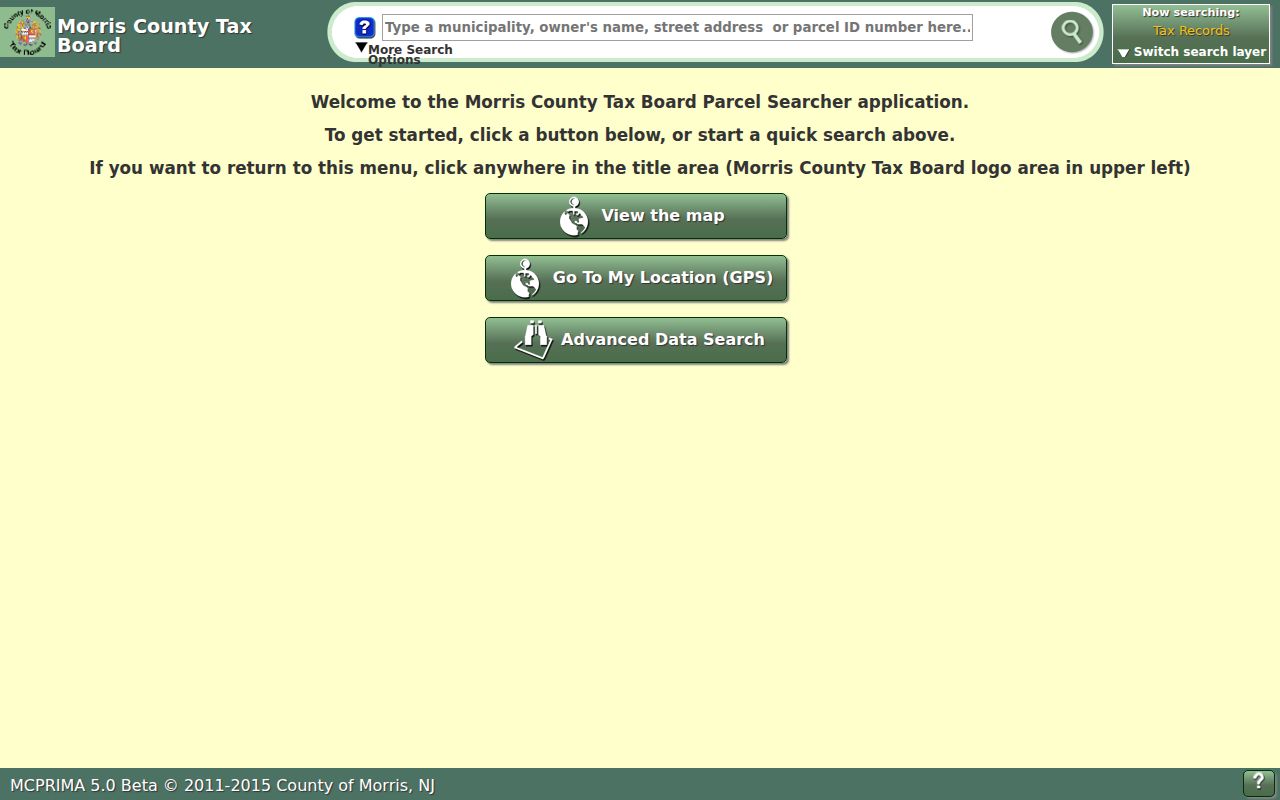
Use the selected parcel to return to the Tax Board record, rather than treating a polygon alone as ownership proof.
The county GIS data inventory identifies the layer families available in the mapping system.
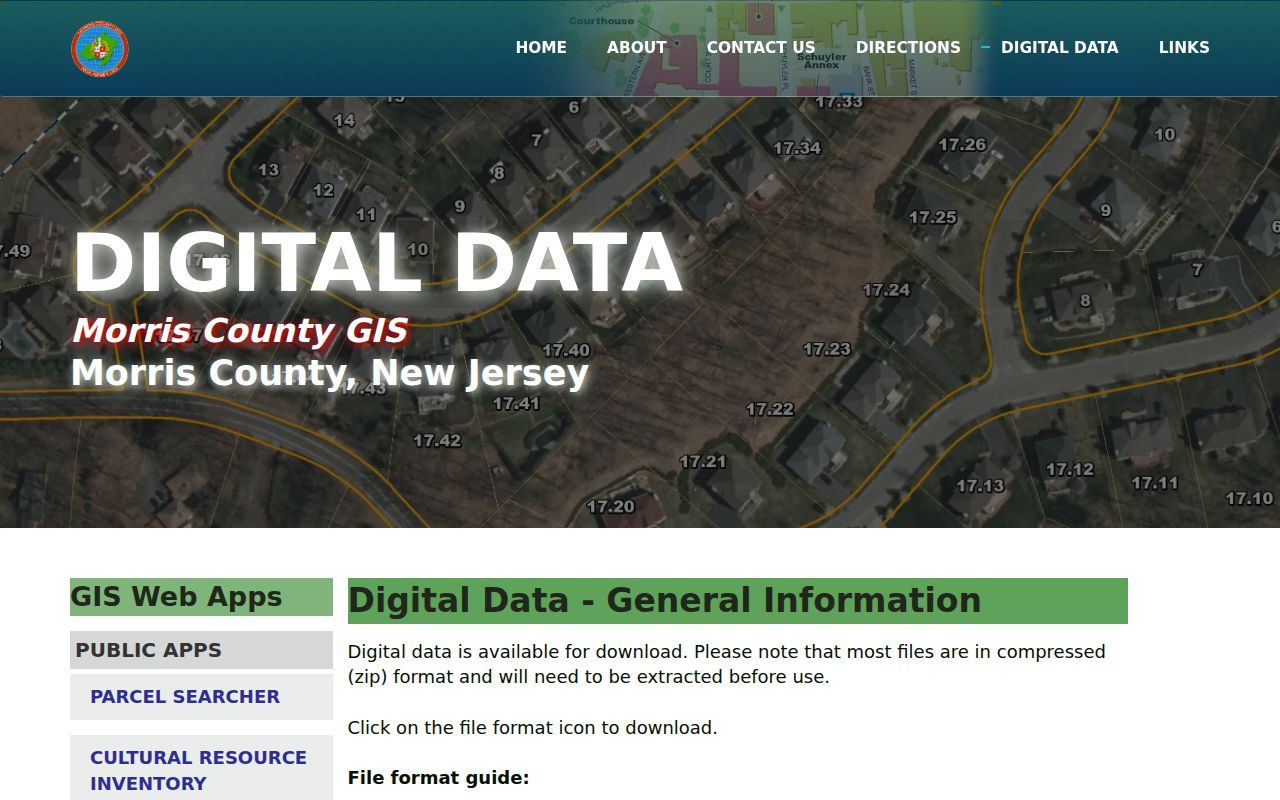
Those layers provide place context around a Randolph street, but they do not turn the viewer into a resident list.
Deeds Along a Randolph Street
The Morris County Clerk recorded-document index is a party and instrument search, not an address directory. Its tabs include Party, Document Type, Instrument Number, Book/Page, Map Number, and Parcel ID. Search a known tax owner by last name then first name, without a comma, and narrow by date or document type. A result can show the party, recording date, instrument number, book and page, consideration, parcel details, legal description, and linked image availability.
For a particular road, compare the deed’s district, map, parcel, and legal wording with the Tax Board result. Search the same party separately for deeds, mortgages, liens, maps, and related filings when those records answer the question. A recorded deed names transaction parties and a date. It does not identify every person who has lived at the street address.
The Clerk’s public-search interface provides the Party Name and document routes used to connect a Randolph parcel to recorded instruments.
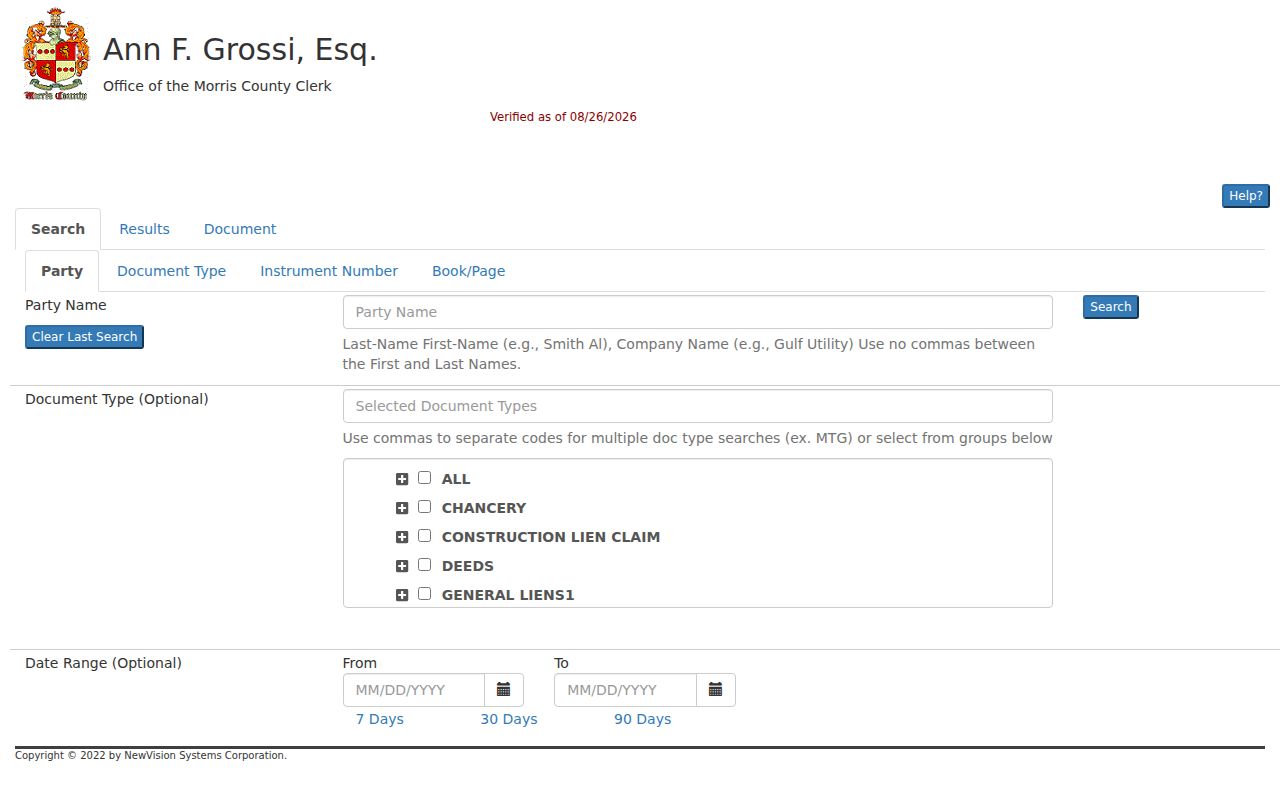
The Clerk reports online property-record coverage from 1960 forward. For older instruments, the Records Vault in Morristown holds books, microfilm, and images reaching to the late 1700s, with counter and mail-request paths.
Randolph Street Directory Record Coverage
Address-keyed sources do different work. The Tax Board establishes the parcel and current owner of record. GIS shows spatial context. The Clerk dates recorded transfers. Township files can document a project tied to an address. Historical directories and census schedules are better suited to dated household research. Treat a name from each source as a role-specific observation, then compare the date and parcel before drawing a conclusion.
| Address record | Randolph keeper | What it can show | Access route |
|---|---|---|---|
| Tax and assessment | Morris Tax Board and municipal assessor | Owner, situs, parcel, prior identifier, tax fields | Free Tax Board interface, 2000–2026 observed |
| Parcel GIS | Morris GIS | Parcel shape, address point, blocks, structures, zoning, flood context | Free viewer; not a survey |
| Recorded documents | Morris County Clerk | Parties, recording date, legal description, book/page, instruments | Free online index from 1960; Records Vault for older material |
| Election registry material | Morris Board of Elections | Statutory district-list fields, subject to access and use limits | Status portal or lawful Board request, not a free street scraper |
| Permits and planning | Randolph Construction Codes and Planning | Project, applicant, contractor, inspection, certificate, or hearing clues | Office request or OPRA; no public result database located |
New Jersey’s voter registry rules do not create an open browse tool for every name along a road. District lists have statutory field and use limits, including a bar on commercial solicitation. The individual status tool is for a person’s registration status, not for compiling a street roster.
Historic Randolph Street Directory Entries
For a past address, move from the parcel trail to the dated street section of a historical directory. Morris County Directories are documented for 1897–1909, and Morristown City Directories for 1885–1982 at the North Jersey History & Genealogy Center. Morris County Library also has area telephone directories from 1969. New Jersey State Library Phonefiche covers changing area titles from 1976–2005, so a Randolph address may be filed under a Morris, Dover-area, or Morristown-area volume rather than a township title.
Read the house-number sequence, cross streets, name spelling, spouse notation, historical role, and abbreviations exactly as printed. The directory evidence should be paired with a deed or tax date, not used in place of one. The collection details belong on the Randolph directory book; here, the value is its street-section view of an earlier address.
Randolph Street Name Continuity
Older Randolph road research has a geography problem as well as a date problem. Randolph was formed from Mendham in 1805 and organized in 1806, so an early farm or family may be indexed under Mendham Township. Mount Freedom, Ironia, Center Grove, Fernbrook, and Shongum are community names within the township, not separate municipal record systems. Postal labels add another layer: Ironia uses 07845, Randolph 07869, and Mount Freedom 07970.
Search older road and community variants beside the current street name. Radtke Road, for example, was originally the Shongum–Mount Freedom Road and was laid out in 1795. The documented 1868 Randolph map, 1887 atlas references, and 1986 historic survey can help bridge a legal description or landmark to a modern address. No verified street-renumbering year was located, so a missing modern number should not be treated as proof that the place was absent.
Randolph Permits by Street Address
Construction Codes and Planning files can add an address-specific date to the street directory trail. Randolph construction work can involve additions, air conditioning, basements, decks, demolitions, pools, roofs, wells, septic systems, solar work, and other projects. Applications and subcode forms may identify the work site, project owner, and contractor. Inspections can lead to certificates of occupancy or approval, while zoning and planning files may show applicants, hearings, variances, and site-plan conditions.
No public online Randolph permit-results search was located. Begin with a known address, block and lot, permit number, or year and contact Randolph Construction Codes. A specific municipal record can also be requested through the Township Clerk’s OPRA route. Ask for an existing, identifiable record rather than a newly created list.
The Township permit source shows the address-keyed application and project workflow.
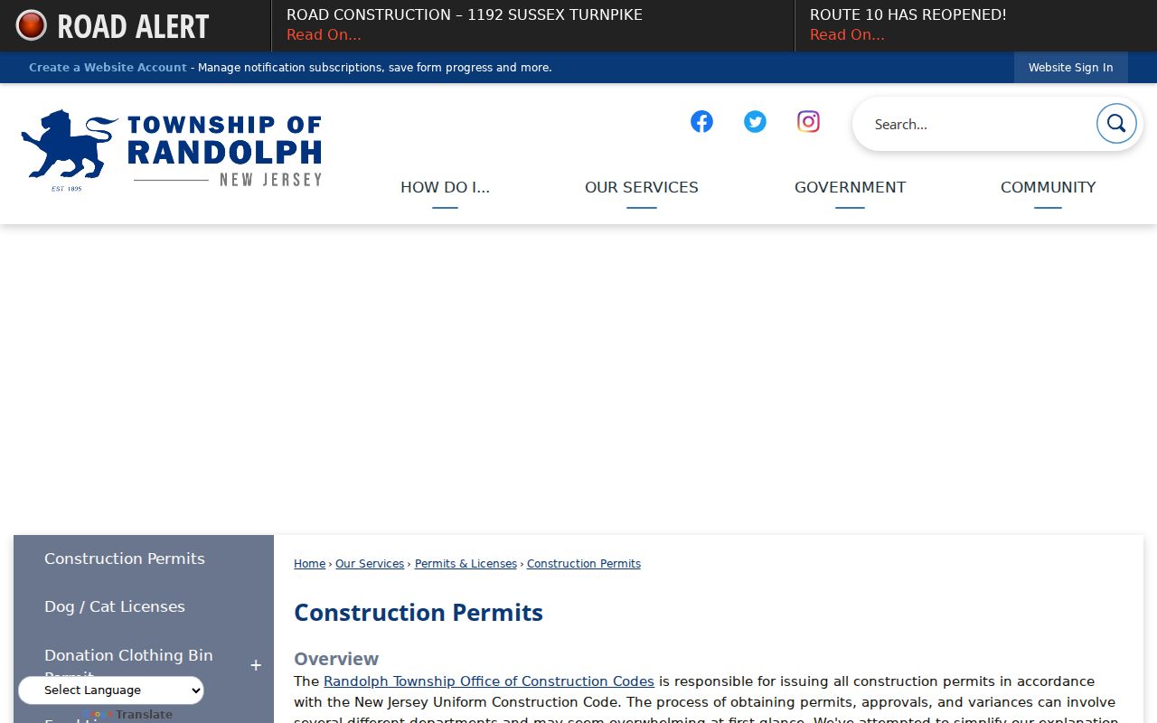
A permit can date work or connect an applicant to a project. It is not a general directory of everyone associated with a street.
Limits of a Randolph Street Directory
No official source creates a complete list of all non-owner occupants, household members, visitors, utility customers, or drivers at a Randolph address. Tax and deed records focus on property and recorded parties. The state voter-status portal does not offer a free-form street download, and protected voters may use a substitute address. Motor-vehicle information is controlled by the Driver Privacy Protection Act, while OPRA also permits protection of sensitive personal details. A map boundary is not proof about a person.
Use a street-by-street record trail for personal research, family history, property curiosity, civic context, or verification of an official record. Confirm a name with its role, date, and parcel. New Jersey’s anti-stalking law, N.J.S.A. 2C:12-10, addresses repeated conduct that causes reasonable fear, and public-record research must never become surveillance, unwanted contact, or harassment.
Lawful use. Randolph address records are for careful, personal research. Do not use them to stalk, harass, intimidate, or harm anyone; report suspicious deed-copy or property-alert demands through official county or township channels.